Leo A. Geis, Principal at Idaho Airships, Inc. of Boise has been seated as a member of the United States Department of Commerce’s (USDOC) National Institute of Standards and Technology (NIST) Organizational Scientific Advisory Committees (OSAC) for Video and Imaging Technology and Analysis.
NIST is one of the nation’s oldest physical science laboratories, having been established by Congress in 1901. NIST provides expertise in various sciences dedicated to enhancing the United States’ economic competitive posture and integrity.
OSAC-as part of the USDOC’s Forensic Science Program-is specifically purposed to develop discipline-specific forensic science protocols and standards for NIST.
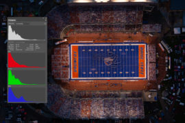
Geis provides the OSAC with expertise in ocular physiology and neurology, color science, and applied thermodynamics; sciences related by their common involvement with light energy and manipulation (photonics).
Geis’ foci include the admissibility and veracity of visual evidence (photography, videography, thermography, etc.) in forensics and litigation, the substandard implementation of imaging and remote sensing within governmental echelons, and human visual performance expectations in various anomalous situations such as traffic accidents and personal injuries.