Category: Aerial Photography & Videography

  • Aerial Photography in Boise, Idaho; Table Rock Fire Aerial Panorama, Idaho, June 2016

    Aerial Photography in Boise, Idaho; Table Rock Fire Aerial Panorama, Idaho, June 2016

    Aerial Photograph of the Table Rock Fire footprint, Downtown Boise, Idaho, and Boise State University
    Aerial Panorama of the footprint of the Table Rock Fire of June, 2016, showing its context: downtown Boise, Boise State University, Harris Ranch, et. al. Click on the image for a larger display.

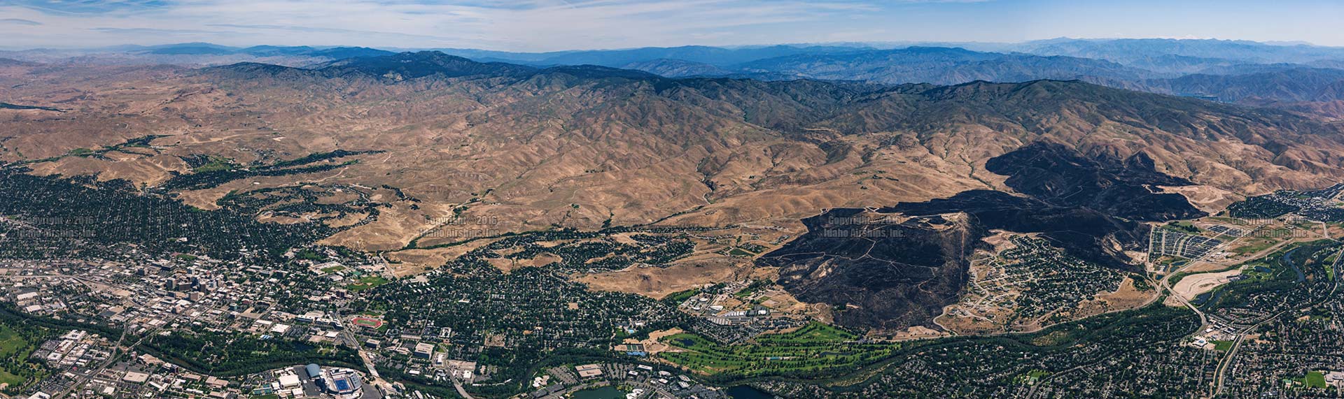
    In late June, 2016 the Table Rock Fire burned approximately 2,500 acres in the East Boise foothills near Harris Ranch and Table Rock. The above aerial photograph is a panorama of the fire’s footprint showing its relationship to downtown Boise, Boise State University, Boise’s Warm Springs Golf Course, the Boise River and Barber Valley, and infrastructure such as the East Parkcenter Bridge.

    (more…)