Aerial Photography in Boise, Idaho; Table Rock Fire Aerial Panorama, Idaho, June 2016

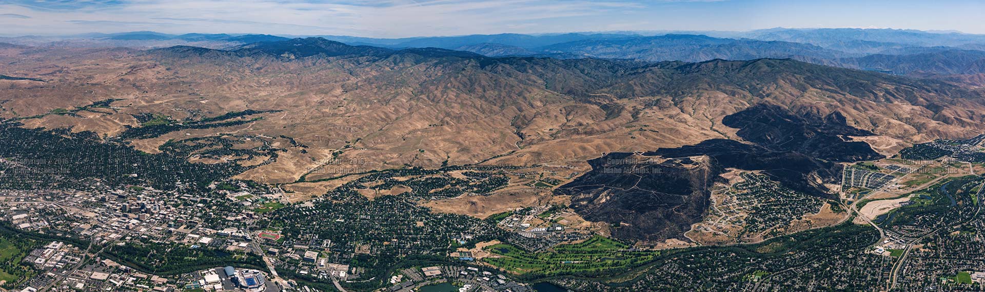
Aerial Photograph of the Table Rock Fire footprint, Downtown Boise, Idaho, and Boise State University
Aerial Panorama of the footprint of the Table Rock Fire of June, 2016, showing its context: downtown Boise, Boise State University, Harris Ranch, et. al. Click on the image for a larger display.

In late June, 2016 the Table Rock Fire burned approximately 2,500 acres in the East Boise foothills near Harris Ranch and Table Rock. The above aerial photograph is a panorama of the fire’s footprint showing its relationship to downtown Boise, Boise State University, Boise’s Warm Springs Golf Course, the Boise River and Barber Valley, and infrastructure such as the East Parkcenter Bridge.

This image was produced on 7/2/16; the original is approximately 12,000 x 3,500 PixEls, or 252 MegaBytes in size (16 bit RGB) and prints sharply beyond 10′ x 3′.


Idaho Airships, Inc. also imaged the fire in progress (on 6/30/16) in Near-InfraRed (720nm).
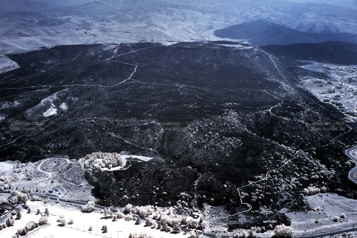
Aerial Near-InfraRed (NIR) image of the Table Rock Fire in Boise, Idaho, During the Burn.
Aerial Near-InfraRed (NIR) image of the Table Rock Fire in Boise, Idaho, during the burn (and firefighting activity). Click on the image for a larger display.

The NIR photograph is especially interesting in that from the aircraft nothing beyond Table Rock (foreground) was visible to due to thick smoke from the burn (see subsequent image). Even though smoke doesn’t affect NIR energy as much as it does visible band energy, attenuation in the distance is obvious. In this image, the large cluster of antennae is 5,832′ from the camera, and the distant burned peak above it is 15,907′ from the camera. The lack of contrast in the background is also evidence of reduced solar influence in the area.
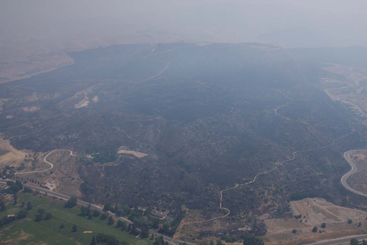

Aerial image of the Table Rock Fire in Boise, Idaho, During the Burn.
Aerial image of the Table Rock Fire in Boise, Idaho, During the Burn. Click on the image for a larger display.

This (above) visible band light image approximates the perspective of the previous (NIR) photograph.

L

Comments

3 responses to “Aerial Photography in Boise, Idaho; Table Rock Fire Aerial Panorama, Idaho, June 2016”

  1. jimbeaux Avatar
    jimbeaux

    …..I thought you said you were not doing aerials anymore….

    1. Leo A. Geis Avatar

      This was shot some time ago; we did sideline the aerial photography & videography for a while due to workload in the new technologies (LiDAR, Thermography) but as of 1/19 enjoy the production capacity to spool up the visible band aerial work again.

  2. Jennifer A Avatar
    Jennifer A

    Hi Leo,
    I have one of your early panoramas of the Boise skyline circa 1999-2000? It’s always been framed ;albeit cheap, yet effective, and in our home since I acquired it. I’m gifting it to my son for Christmas, as he lives in Boise and was 4or 5 years old when we got it. Do you have any current Boise skyline for sale? I’d love to have the comparison!! Hope to hear from you.

Leave a Reply

Your email address will not be published. Required fields are marked *