
Forensic LiDAR and “engineering grade” or “survey grade” LiDAR (LASER Scanning) are very different things. Applications in which engineering and survey LiDAR conventions are manifestly deficient include litigation and its ADR cousins.
No conclusions should be generated using the data or apparent conclusions contained in this post. This is a demonstration of technique, not of metrologic results.
Supporting a particular legal case generates diverse strategies and tactics that are absent in survey and engineering LiDAR assays.
Adding to the intricacies of forensic LiDAR applications, the practitioner must understand much, much more about various materials, geometries, and processing1 than is common, and be able to communicate those matters succinctly and effectively to triers of fact. These proficiencies must include the statistical quantification of uncertainties and calibration conventions.
As with similarly complex thermography, refined manufacturing has generated devices that will produce regimented data sets with the press of a button, and software that will perform generalized processing with ease, effectively cloaking the vast scientific foundations necessary to appropriately tailor output to particular ambitions.
Underappreciated applications for terrestrial LiDAR include construction and craning accidents, dam reactions to hydrostatic pressure, regular infrastructure monitoring (especially of bridges), and extreme-specification mapping such as is accomplished for beam deflection and floor flatness assays.
One of the most potent applications for forensic LiDAR is modeling-over time-the translation (movement) of structures and clusters of structures. Terrestrial “Time Lapse” LiDAR 2 allows the competent forensic practitioner to support geotechnical diagnoses and remedy formulation as well as legal prophylaxis for unstable foundations or defective construction.
Idaho Airships, Inc. has modeled “dynamic venues” in support of geotechnical diagnoses3 and demonstratives by visualizing composite translation as well as discreet axial translations-a potent technique for distinguishing causation and advancing solutions.
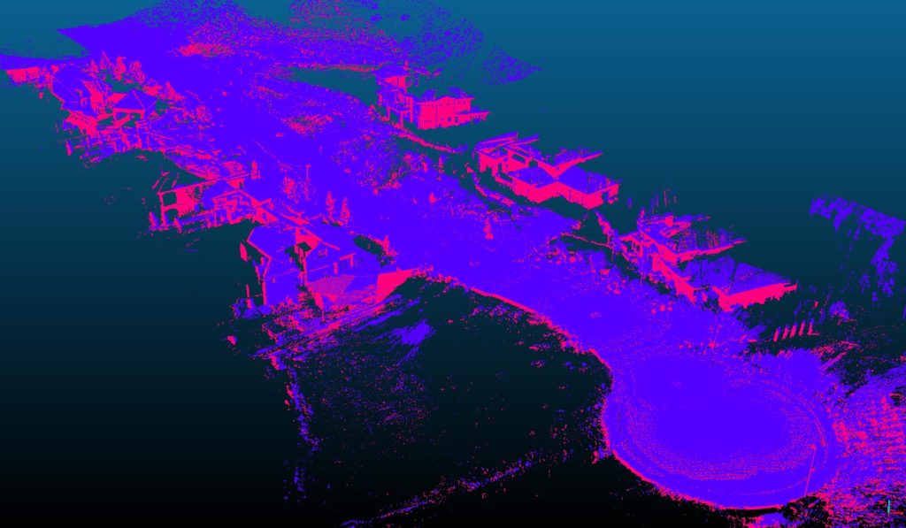
Simply Assigning A Discreet Coloration to Point Clouds Produces an Objectionably Ambiguous, Modestly Descriptive Visual.
By locating point clouds accurately in 3D space they may be usefully juxtaposed. However, simply assigning discreet coloration to each entity may produce confusion in 2D aspects. In the image above, the “blue” point cloud was acquired 5 months prior to the “red.” Both are quite precisely located in digital space; accommodations for the projection of the earth onto a plane are necessary to preserve spatial veracity and allow various operations within a Euclidean geometric system.
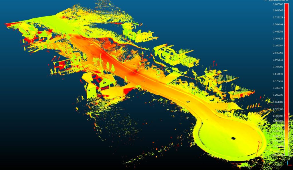
Indicating Total Translation Distance (Along All Axes) is Useful but Still Busy. The Selection and Distribution of Color Does Effectively Highlight The Escarpment on the “Opposite” Side of the Street, But Also Exaggerates Some Structural Phenomena.
It is important to note that total translation conclusions are not a linear sum of x, y, and z translations; rather, they represent a “shortest distance in 3D space,” though alternatives may be specified otherwise in the assay software. Isolated axial distances refer only to calculated distances on that particular axis.
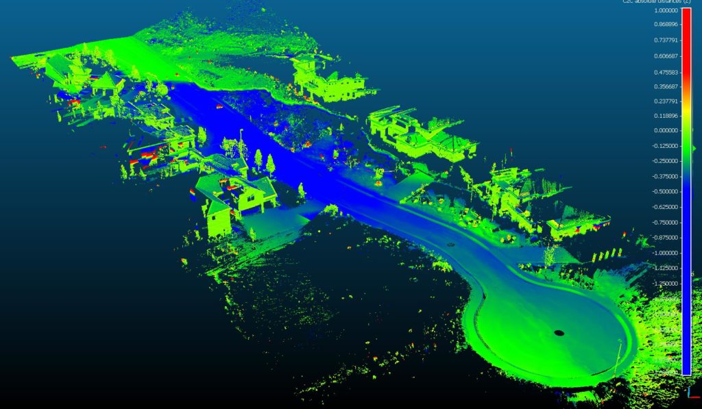
This image demonstrates translation only up or down; the “z” axis relative to earth’s center. This is an extremely useful visualization resulting in substantial clarifications. The z axis is accurately aligned to better than +/-.015°. Green indicates subsidence of approximately 0-125mm (0-6 inches) while blue indicates subsidence of approximately 375mm (15 inches) through 2m (79 inches).
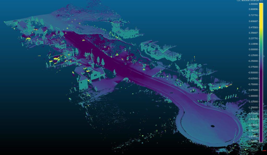
In “micro” assays-such as that of a single home (which was accomplished in this project and dozens of others)-even more information may be effectively visualized because of the reduced scope and increased density of the point cloud.
Qualified forensic LiDAR can effectively indicate various uniaxial and multiaxial phenomena such as distance, volumetrics, shearing, complex rotations, curvilinear distortions, tilt, and other anomalies useful for differential geotechnical and structural diagnoses.
L
- For example, standard LiDAR collection and processing generates incontrovertible collisions with the provisions of 28 USC §1732 and FRE 1001(e). ↩
- Aerial LiDAR-including “drone” (sUAS) LiDAR and SfM (Structure from Motion) spatial data sets generated by visible band photography demonstrably do not provide the aspect, density, or accuracy necessary for this type of forensic project.) ↩
- Primarily out of Idaho. ↩


1 Comment
Great explanation of the principles of measuring movement of “stationary” objects.